September 21, 2025, 02:20:29 PM

Show Posts

This section allows you to view all posts made by this member. Note that you can only see posts made in areas you currently have access to.


Messages - toxictwister00

Pages: 1 ... 389 390 [391] 392 393 ... 470
5851
Local Forecast / Re: April 2009 playlist delayed!
« on: April 02, 2009, 09:01:31 PM »
I personally think you area all overreacting to this thing and are getting a bit too over obsessed about the Local Forecast music... I think you all should take it down a notch or two. :yes:

 :yes:

5852
General Discussion / Re: Report cards
« on: April 02, 2009, 04:21:59 PM »
I got my report card today and this is what my grades looked like for Q3 of the schoolyear (up until last week)

Spanish 2 - 94%  :happy:
SAT Test Prep - 91%  :huh:
Intmd. Team Sports -91%  :)
Adv. Alg. and Trig. - 71%  :angry: :thumbdown: :itsok:

5853
Emulator Videos / Re: SnowManiac's Emulations
« on: April 01, 2009, 10:06:01 PM »
WeatherStar XL Emulation - Music Error


The video starts off with a station ID, then the LF intro which goes into the LF, the song that starts off is "November" by Mark Krurnowski when it fails halfwaythrough to "Evening"/"Pier 32" by Trammell Starks. The original song recorded to this emulation was "Mexicoco" by Wayman Tisdale, but I had a copyright issue with that song before I closed my old account, if you like to hear and watch the original, it's attached below.

5854
Emulator Videos / Re: kpetree10's Emulators
« on: April 01, 2009, 09:47:07 PM »
I really liked it! Great job! :biggrin:

5855
Emulator Videos / Re: SnowManiac's Emulations
« on: April 01, 2009, 06:14:44 PM »
Here' a degraded WeatherStar4000.


5856
General Weather Chat / Re: Southeast Severe Weather
« on: April 01, 2009, 06:06:50 PM »
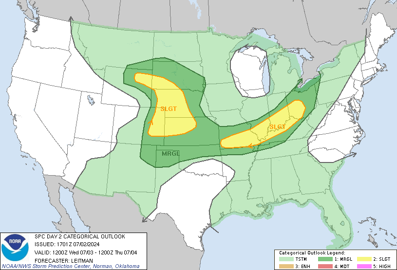
I'm going to get more severe weather tomorrow, this one looks to be more serious than last week's event, Dr. Forbes and Jim Cantore both said the greatest threat will be long tracking tornados, the SPC issued a moderate risk for severe storms in Alabama and Mississippi. I'm going to keep my eye on this as Cantore said it only takes a little bit of sunshine to destablize the atmosphere and cause it to get violent. The edge of the moderate risk is just west of Atlanta.


Quote
Forecast Discussion

   SPC AC 011730
   
   DAY 2 CONVECTIVE OUTLOOK 
   NWS STORM PREDICTION CENTER NORMAN OK
   1230 PM CDT WED APR 01 2009
   
   VALID 021200Z - 031200Z
   
   ...THERE IS A MDT RISK OF SVR TSTMS FROM PARTS OF SWRN TN...MS AL
   AND WRN GA...
   
   ...THERE IS A SLGT RISK OF SVR TSTMS FROM THE LOWER MS VALLEY...SRN
   PARTS OF THE OH VALLEY AND MUCH OF THE SERN STATES...
   
   ...SYNOPSIS...
   
   SHORTWAVE TROUGH NOW OVER THE CNTRL ROCKIES WILL MOVE SE INTO THE
   SRN PLAINS TONIGHT BEFORE EJECTING ENEWD THROUGH THE SERN STATES
   THURSDAY. ATTENDANT LEE CYCLONE OVER OK EARLY THURSDAY WILL LIFT
   ENEWD THROUGH THE LOWER MS AND TN VALLEYS...REACHING THE OH VALLEY
   OVERNIGHT. TRAILING PACIFIC FRONT WILL ADVANCE EAST AND EXTEND FROM
   THE WRN CAROLINAS SWWD THROUGH THE WRN FL PANHANDLE BY THE END OF
   THE PERIOD. WARM FRONT OVER THE NRN GULF WILL LIKELY LIFT NWD INTO
   THE GULF COASTAL STATES...BUT NWD PROGRESSION OF THIS BOUNDARY MAY
   BE LIMITED TO SOME DEGREE BY THE POTENTIAL FOR ONGOING CONVECTION.
   
   
   ...LOWER MS VALLEY THROUGH SERN STATES AND TN VALLEY...
   
   THREAT STILL EXISTS FOR A SIGNIFICANT SEVERE EVENT OVER A PORTION OF
   THE SERN STATES. HOWEVER POTENTIAL LIMITING FACTORS DO EXIST. THE
   RICH LOW LEVEL MOISTURE WITH DEWPOINTS IN THE UPPER 60S TO AROUND 70
   HAS BEEN SHUNTED SWD INTO THE NRN GULF SOUTH OF A CONVECTIVELY
   ENHANCED FRONTAL BOUNDARY. POTENTIAL COMPLICATING FACTORS INVOLVE
   IMPULSES EMBEDDED WITHIN THE SUBTROPICAL JET STREAM. ONE SUCH
   IMPULSE IS FORECAST TO EJECT NEWD THROUGH THE NRN GULF REGION EARLY
   THURSDAY WITH A CORRESPONDING INCREASE IN THE LOW LEVEL JET. THIS
   WILL LIKELY ENHANCE LIFT IN VICINITY OF THE BOUNDARY OVER THE NRN
   GULF...RESULTING IN THE DEVELOPMENT OF STORMS. CONCERN IS THAT THIS
   ACTIVITY MAY LIMIT THE NWD RETURN OF THE RICH GULF MOISTURE TO SOME
   EXTENT WITH LOW TO MID 60S MORE LIKELY OVER THE SERN STATES THAN
   UPPER 60S INLAND FROM COASTAL AREAS. REMNANT EML WILL LIKELY ADVECT
   EWD ABOVE THE RETURNING MOIST AXIS...AND IN ADDITION TO POTENTIAL
   FOR EARLY STRATUS COULD RESULT IN A CAP IN MUCH OF THE WARM SECTOR.
   THE ATMOSPHERE WILL LIKELY UNDERGO SOME DESTABILIZATION DURING THE
   DAY AS MOISTURE RETURNS NWD AND LOW CLOUDS BEGIN TO MIX OUT...WITH
   MLCAPE FROM 1000-1500 J/KG.
   
   STORMS WILL LIKELY BE ONGOING WITHIN ZONE OF FORCING/DPVA ALONG AND
   JUST AHEAD OF THE FRONT AND ATTENDANT SHORTWAVE TROUGH FROM ERN TX
   INTO AR. THIS ACTIVITY WILL LIKELY CONTINUE EAST DURING THE DAY AND
   GROW UPSCALE INTO AN MCS. ACTIVITY WILL BE EMBEDDED WITHIN STRONG
   VERTICAL SHEAR WITH HODOGRAPHS SUFFICIENT FOR EMBEDDED SUPERCELLS
   AND LEWP STRUCTURES. THE STORMS WILL LIKELY INTENSIFY AS THE
   ATMOSPHERE DESTABILIZES DOWNSTREAM. DAMAGING WIND...LARGE HAIL AND
   TORNADOES WILL BE POSSIBLE WITH THIS ACTIVITY.
   
   FARTHER EAST IN THE WARM SECTOR ACROSS AL...LOW LEVEL HODOGRAPHS
   WILL INITIALLY NOT BE PARTICULARLY LARGE DUE TO THE SPLIT LOW LEVEL
   JET STRUCTURE WITH ONE BRANCH FARTHER WEST IN ASSOCIATION WITH THE
   PROGRESSIVE SHORTWAVE TROUGH...AND ANOTHER BRANCH FARTHER SWD ALONG
   THE GULF COAST. DISCRETE INITIATION AWAY FROM THE FRONTAL BOUNDARY
   IS POSSIBLE BUT IS MORE UNCERTAIN DUE TO POTENTIAL FOR AT LEAST A
   MODEST CAP AND PRESENCE OF LOW CLOUDS. HOWEVER...IF SUFFICIENT
   BREAKS OCCUR A FEW DISCRETE STORMS MAY DEVELOP DURING THE AFTERNOON.
   THE LOW LEVEL JET WILL LIKELY STRENGTHEN WITH TIME IN THIS REGION AS
   THE UPPER TROUGH CONTINUES EAST. IF DISCRETE MODES CAN DEVELOP AND
   BE MAINTAINED AS THE LOW LEVEL JET STRENGTHENS...THE THE TORNADO
   THREAT WOULD CORRESPONDINGLY BE HIGHER.
   
   OTHER SEVERE STORMS WILL BE LIKELY WITH CONVECTION DEVELOPING IN
   VICINITY OF THE BOUNDARY ALONG THE GULF COASTAL REGION.
   
   ...SE GA INTO CAROLINAS...
   
   THE UPPER TROUGH AND STRONGER LOW-MID LEVEL FLOW WILL SHIFT ENEWD
   THROUGH SRN GA AND THE CAROLINAS OVERNIGHT. SOME INLAND RECOVERY IS
   POSSIBLE...ESPECIALLY FROM SRN GA INTO THE ERN CAROLINAS AS THE
   BOUNDARY LAYER FLOW STRENGTHENS. THREAT WILL EXIST FOR ORGANIZED
   STORMS INCLUDING SUPERCELLS WITH DAMAGING WIND...ISOLATED TORNADOES
   AND LARGE HAIL POSSIBLE.
   
   ..DIAL.. 04/01/2009
   
   CLICK TO GET WUUS02 PTSDY2 PRODUCT

   NOTE: THE NEXT DAY 2 OUTLOOK IS SCHEDULED BY 0600Z
   CURRENT UTC TIME: 2203Z (6:03PM), RELOAD THIS PAGE TO UPDATE THE TIME
       

5857
General Discussion / Re: The Front Porch
« on: April 01, 2009, 05:23:11 PM »
I don't consider it a holiday either :no: , just a day to play tricks and pranks on people.

5858
What songs and playlist did TWC use 2 cuts of?

I know...
Nova Bosa by Patrick Yandall - March 07 :00 and 1:58 in Primetime
Winter by Ryan Farish- :12 from primetime and 2:04 from overnight
It's For You by Pat Metheny- :00 and 6:18? from Sept 07 Daytime

I have this song and I think the second cut starts around 4:08,but I'm not completely positive. :dunno:

5859
General Discussion / Re: The Front Porch
« on: April 01, 2009, 03:51:12 PM »
I had a stupid moment this morning before I left for school, I let my guard down and my grandma told me I had a loose string on my shirt, I looked and she said "April Fools"! I never fall for stuff like that anymore, but I had completely forgotten what today was. She finally got me after all the other times in years past I have tricked her. :doh: :doh2:

5860
General Discussion / Re: What have you eaten today?
« on: March 31, 2009, 06:54:50 PM »
B -  :thinking:
L - something from home to avoid paying $2 for crappy school   lunches.  :thumbdown:
D - Publix Sub sandwich  :)

5861
The Game Room / Re: Ban the Person above you
« on: March 30, 2009, 05:22:00 PM »
Banned for being online.

5862
General Discussion / Re: Happy Birthday, Derek and Travis!
« on: March 30, 2009, 04:40:08 PM »
Happy Birthday guys, I hope it's been going great so far! :twothumbs:

5863
General Discussion / Re: The Front Porch
« on: March 29, 2009, 09:00:48 PM »
Dang, you all are so lucky. It's been nothing but clear skies here. :/

I can't believe you actually said that. I was undressing coming home from church, and I was in the laundry closet, and the lights went out, then the next thing I know, I feel my house shaking. I know it wasn't a earthquake, cuz Gary would've told you lot about it.

Live severe Weather Coverage for the heck of it:
http://www.ustream.tv/channel/live!-w-evan
Copy and paste everything in the link above (Which includes !-w-evan)

Good thing I went to the home depot before the storm.  I hooked up the generator and it worked! No thanks to my damn huzzy. <_<

What are you talking about, Lamarr? :rolleyes:


Also, my name is Rico Jose Maldonado-Winchester. Get it straight. :D

prove it


 :doh: Oy! Here we go with this crap again.

5864
Local Forecast / Re: General LF Discussion
« on: March 29, 2009, 07:45:48 PM »
Did they reduce the number of beeps for a Severe Thunderstorm Warning crawl from 7 to 4? Both warnings I've had only had 4 beeps...

I think they did, I was under a Severe T-Storm Warning and Flood Warning yesterday and it only beeped 4 times.

5865
The Game Room / Re: TV Slogans
« on: March 28, 2009, 11:27:32 PM »
What about
Global's got it in bed (1976-2006)
That sounds dirty  :blink:

I've read dirtier ones in here. :P

Pages: 1 ... 389 390 [391] 392 393 ... 470