November 16, 2025, 10:39:30 AM

Show Posts

This section allows you to view all posts made by this member. Note that you can only see posts made in areas you currently have access to.


Messages - toxictwister00

Pages: 1 ... 213 214 [215] 216 217 ... 470
3211
Hurricane Central / Re: Hurricane Irene
« on: August 24, 2011, 10:39:52 AM »
If Irene brushes or completely misses the tip of Cape Hatteras and makes a run towards SE Mass as a Cat 2 or 3 the damage would be catastrophic

Do you sit at a very low elevation and are you gathering up any hurricane supplies to ride it out? Watching Dr. Knabb this morning he brought up what I would consider to be the worst case scenario for the entire northeast region and that is if Irene manages to travel along the gulf stream while at the same time being pulled north by an incoming trough around this weekend she'll probably be moving fast enough that she won't have time to weaken quickly. That's why I also brought up about if Irene could become annular shaped while it's rapidly developing in this thread because from what I've read on them, they can become immune to unfavorable conditions such as cool SST's, wind shear, dry air, etc.

3212
Everything Else TWC / Re: General TWC Discussion
« on: August 24, 2011, 09:55:41 AM »
Steph said at the end of YWT, she's heading to the Outer Banks for Hurricane Irene tomorrow.

3213
Hurricane Central / Re: Hurricane Irene
« on: August 24, 2011, 09:18:45 AM »
Anybody thinks there's a chance Irene could become annular shaped? It seems like a lot of the convection to the east near Haiti/DR is being shredded away from her and she looks more "circular" to me.


An example of an annular hurricane Isabel (2003)

3214
Hurricane Central / Re: Hurricane Central 2011
« on: August 24, 2011, 08:34:17 AM »
I know were all preoccupied with Irene, but there is another invest out in the East Atlantic that could be making a run towards becoming Jose. It looks to be a fish right now if it does develop.

Invest 90L
Quote
2. SHOWERS AND THUNDERSTORMS CONTINUE TO SHOW SIGNS OF ORGANIZATION
IN ASSOCIATION WITH AN AREA OF LOW PRESSURE LOCATED ABOUT 100 MILES
SOUTH OF THE CAPE VERDE ISLANDS.  ENVIRONMENTAL CONDITIONS APPEAR
GENERALLY FAVORABLE FOR SLOW DEVELOPMENT OF THIS LOW DURING THE
NEXT SEVERAL DAYS.
THIS SYSTEM HAS A MEDIUM CHANCE...50 PERCENT...
OF BECOMING A TROPICAL CYCLONE DURING THE NEXT 48 HOURS AS IT MOVES
WESTWARD AT 10 TO 15 MPH.

3215
Hurricane Central / Re: Hurricane Irene
« on: August 24, 2011, 08:01:05 AM »
Irene is officially the first major hurricane of the 2011 hurricane season


BULLETIN
HURRICANE IRENE INTERMEDIATE ADVISORY NUMBER  16A
NWS NATIONAL HURRICANE CENTER MIAMI FL       AL092011
800 AM EDT WED AUG 24 2011

...IRENE BECOMES A CATEGORY THREE HURRICANE....EYE HEADED FOR THE
CROOKED AND ACKLINS ISLANDS...

3216
Hurricane Central / Re: Hurricane Irene
« on: August 24, 2011, 12:54:53 AM »
From another forum...

----- Current Analysis -----
Date : 24 AUG 2011 Time : 031500 UTC
Lat : 21:10:00 N Lon : 72:09:49 W

CI# /Pressure/ Vmax
5.4 / 954.1mb/ 99.6kt


Final T# Adj T# Raw T#
5.4 5.8 6.1

Pressure still steadily falling...

Here's a picture of Irene to leave you with before I head off to bed.  ;)


3217
Hurricane Central / Re: Hurricane Irene
« on: August 23, 2011, 11:05:40 PM »
NHC forecasts a Cat 1 Hurricane Irene making landfall on NYC on Sunday Night.


3218
Hurricane Central / Re: Hurricane Irene
« on: August 23, 2011, 10:08:42 PM »
Wobble? :blink:


Convection starting to wrap/consolidate all around the eye
http://www.ssd.noaa.gov/goes/flt/t2/flash-rb.html

3219
Hurricane Central / Re: Hurricane Irene
« on: August 23, 2011, 09:10:21 PM »
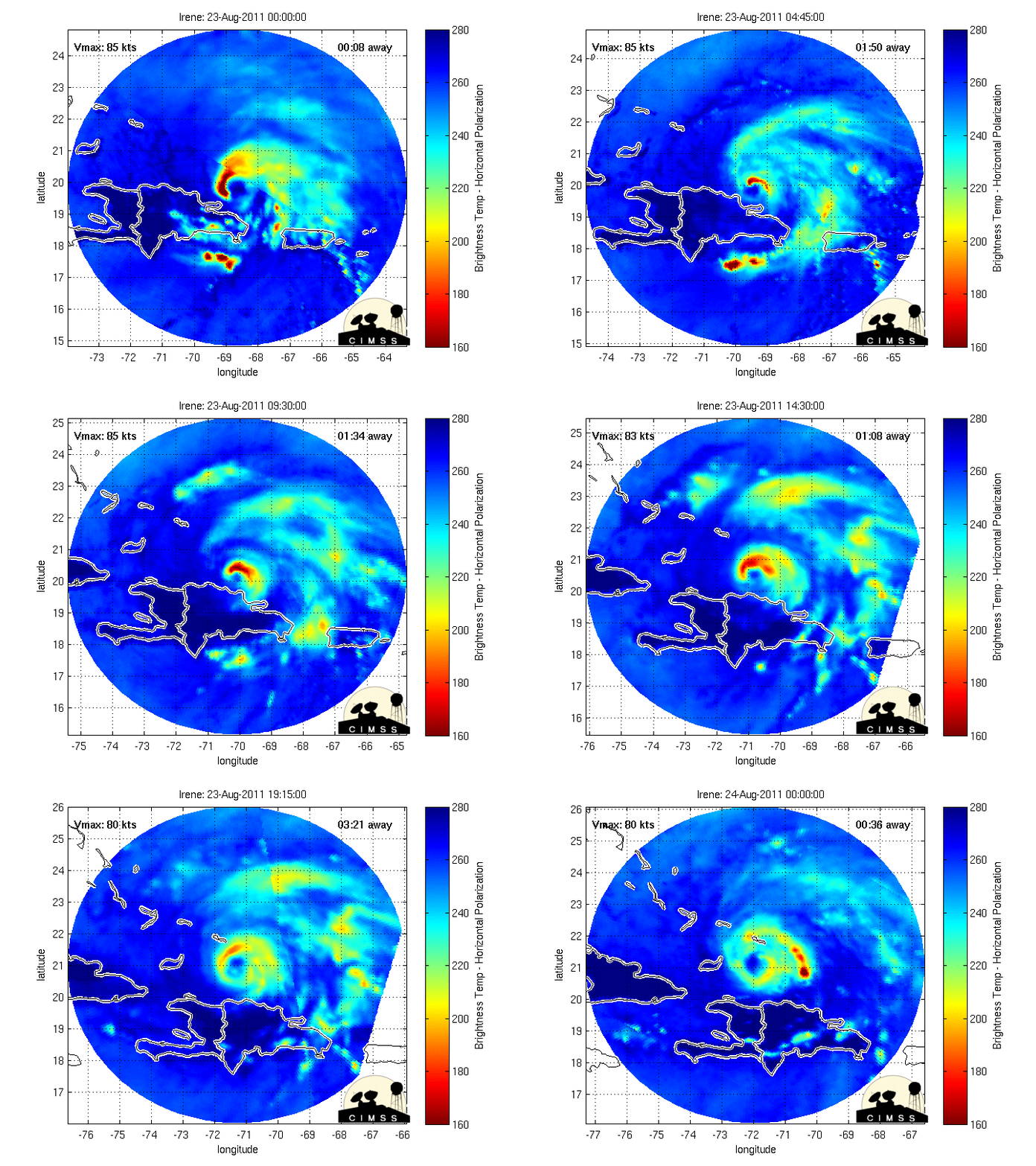
I think the dynamite is about to be lit with Irene, I believe RI (rapid intensification) is occurring. Also the eye is appearing again.


if Irene does rapidly intensify, how much do you think the wind speed, wind direction, and how many MB's will the pressure fall?

Forecast Models on Stormpulse


Wind speeds I'm thinking 135-145mph (Cat 4) range, but it may weaken some beforehand if it slows down/stalls before making it to NC. As far as pressure, already some early reports of 964mb from hurricane hunters I can see it dropping another 20-35mbs.

3220
Hurricane Central / Re: Hurricane Irene
« on: August 23, 2011, 08:50:32 PM »
I think the dynamite is about to be lit with Irene, I believe RI (rapid intensification) is occurring. Also the eye is appearing again.


3221
Everything Else TWC / Re: General TWC Discussion
« on: August 23, 2011, 08:10:49 PM »
Is "Breaking NOW" supposed to be "Breaking NEWS" on weather.com right now? :unsure: They may end up changing this before anyone gets to see it.

I don't think it's a typo, I think it's supposed to say "Breaking Now"

Anybody a little surprised Jim is still in the studio tonight? They sent Mike Sidel out to FL (he'll probably be relocated) and Eric out to NC. I figured Jim would be the first or one of the first to be deployed out to a location for Hurricane Irene.

3222
Hurricane Central / Re: Hurricane Irene
« on: August 23, 2011, 07:57:45 PM »
8:00 PM EDT Tue Aug 23
Location: 21.1°N 71.8°W
Max sustained: 90 mph
Moving: WNW at 9 mph
Min pressure: 969 mb

She's pulling an Ike on us, pressure is dropping rapidly while winds are holding steady. I'm sure the winds will play catch up over the next several hours.

3223
General Discussion / Re: Earthquake Rattles East Coast/Mid-Atlantic
« on: August 23, 2011, 05:19:40 PM »
Andy, you forgot tornadoes, tsunamis and blizzards too :P it was def my first earthquake, I didn't even know we had a fault line

Well I was mainly talking about events that have happened this summer (I guess I should have included tornadoes on the list, though.) :P

Anyway, are there any reports of damage in the NE?

Our local news here showed video of building damage in Washington,DC.

3224
Hurricane Central / Re: Hurricane Irene
« on: August 23, 2011, 04:59:13 PM »
Irene has weakened to 90mph as of 5pm advisory.


3225
General Discussion / Re: Poll - Male users: Do you ever wear pink
« on: August 23, 2011, 04:20:47 PM »
I don't have a problem wearing a pink shirt, but I don't have one. I don't think I've ever worn anything with pink in it.

Pages: 1 ... 213 214 [215] 216 217 ... 470