November 16, 2025, 12:52:12 PM

Show Posts

This section allows you to view all posts made by this member. Note that you can only see posts made in areas you currently have access to.


Messages - toxictwister00

Pages: 1 ... 210 211 [212] 213 214 ... 470
3166
Hurricane Central / Re: Hurricane Irene
« on: August 26, 2011, 09:38:02 PM »
Bryan Norcross said all NYC airports will be closing at noon tomorrow.

3167
Local Forecast / Re: General LF Discussion
« on: August 26, 2011, 09:24:30 PM »
I've been meaning to ask this for the longest time, but are they ever going to fix that pesky glitch of the Satellite LDL being underneath the IntelliStar LDL?

3168
Hurricane Central / Re: Hurricane Irene
« on: August 26, 2011, 09:13:18 PM »
Wrightsville, NC and other webcams

http://www.surfchex.com/index.php

3169
Hurricane Central / Re: Hurricane Irene
« on: August 26, 2011, 08:22:00 PM »
Tornado Watch #809 in effect for Eastern North Carolina via SPC

Quote
WOUS64 KWNS 270008
     WOU9
     
     BULLETIN - IMMEDIATE BROADCAST REQUESTED
     TORNADO WATCH OUTLINE UPDATE FOR WT 809
     NWS STORM PREDICTION CENTER NORMAN OK
     815 PM EDT FRI AUG 26 2011
     
     TORNADO WATCH 809 IS IN EFFECT UNTIL 500 AM EDT FOR THE
      FOLLOWING LOCATIONS
     
     NCC013-019-031-049-055-095-103-129-133-137-141-177-270900-
     /O.NEW.KWNS.TO.A.0809.110827T0015Z-110827T0900Z/
     
     NC
     .    NORTH CAROLINA COUNTIES INCLUDED ARE
     
     BEAUFORT             BRUNSWICK           CARTERET           
     CRAVEN               DARE                HYDE               
     JONES                NEW HANOVER         ONSLOW             
     PAMLICO              PENDER              TYRRELL   


     AMZ130-135-150-152-154-156-158-250-252-270900-
     /O.NEW.KWNS.TO.A.0809.110827T0015Z-110827T0900Z/
     
     CW
     
     .    ADJACENT COASTAL WATERS INCLUDED ARE
     
     ALBEMARLE SOUND
     
     PAMLICO SOUND
     
     COASTAL WATERS FROM CURRITUCK BEACH LIGHT TO OREGON INLET NC OUT
     20 NM
     
     COASTAL WATERS FROM OREGON INLET TO CAPE HATTERAS NC OUT 20 NM
     
     COASTAL WATERS FROM CAPE HATTERAS TO OCRACOKE INLET NC OUT 20 NM
     
     COASTAL WATERS FROM OCRACOKE INLET TO CAPE LOOKOUT NC OUT 20 NM
     
     COASTAL WATERS FROM CAPE LOOKOUT TO SURF CITY NC OUT 20 NM
     
     COASTAL WATERS FROM SURF CITY TO CAPE FEAR NC OUT 20 NM
     
     COASTAL WATERS FROM CAPE FEAR NC TO LITTLE RIVER INLET SC OUT 20
     NM
     
     ATTN...WFO...MHX...ILM...


http://www.spc.noaa.gov/products/watch/ww0809.html

3170
Hurricane Central / Re: Hurricane Irene
« on: August 26, 2011, 08:12:25 PM »
Some weather porn.  :P


3171
Hurricane Central / Re: Hurricane Irene
« on: August 26, 2011, 08:07:19 PM »
So basically Irene could still take the farther eastern track over RI because of the NNE turn?

It can, but it's very unlikely. The center is still right on track with the NHC's track, it was slightly due west of north earlier today.


3172
Hurricane Central / Re: Hurricane Irene
« on: August 26, 2011, 07:51:21 PM »
BULLETIN
HURRICANE IRENE INTERMEDIATE ADVISORY NUMBER  26A
NWS NATIONAL HURRICANE CENTER MIAMI FL       AL092011
800 PM EDT FRI AUG 26 2011

...IRENE TURNS TOWARD THE NORTH-NORTHEAST...TROPICAL STORM
CONDITIONS SPREADING INLAND OVER SOUTHEASTERN NORTH CAROLINA...


SUMMARY OF 800 PM EDT...0000 UTC...INFORMATION
----------------------------------------------
LOCATION...32.1N 77.2W
ABOUT 180 MI...290 KM SSW OF CAPE LOOKOUT NORTH CAROLINA
ABOUT 235 MI...380 KM SSW OF CAPE HATTERAS NORTH CAROLINA
MAXIMUM SUSTAINED WINDS...100 MPH...160 KM/H
PRESENT MOVEMENT...NNE OR 15 DEGREES AT 14 MPH...22 KM/H
MINIMUM CENTRAL PRESSURE...950 MB...28.05 INCHES

3173
Hurricane Central / Re: Hurricane Irene
« on: August 26, 2011, 02:26:05 PM »
It seems like the drought conditions in the Southeast may actually be helping here with all the dry air being advected into Irene.  The western portion is becoming quite poor in organization.  It doesn't look like it will ever become a major hurricane again as the stronger winds aloft are not being mixed down to the surface.  The decreasing water temperatures ahead, increasing wind shear as it gets picked up into the upper-level trough, and the interaction with land are all going to slowly weaken this hurricane.  The biggest threats are now waves and storm surge, but the large wind field will still be an issue for many areas.
Don't forget the flooding...

3174
Hurricane Central / Re: Hurricane Irene
« on: August 26, 2011, 11:27:33 AM »
To be blunt, Hurricane Irene is really getting her ass kicked by the dry air on the SE coast and there's also inreasing shear on the NE side that's playing a factor in why she's been getting progressively worse than better. Not to mention not able to maintain a stable eye for very long, but that doesn't lessen the threat as far as flooding and wind damage goes because of how massive her wind field still is. There's already reports of tropical storm force winds and power outages in SC from extreme outer rain-bands brushing into the area.

EDIT: Notice how the eyewall collapses considerably in the last frames here


http://www.ssd.noaa.gov/goes/flt/t2/flash-wv.html

3175
Everything Else TWC / Re: General TWC Discussion
« on: August 26, 2011, 11:10:09 AM »
This whole "Weather Channel Social" is already getting annoying. I mean, yeah its nice.. but, whenever the average viewer wants information about storms, this is a little unnecessary.

It's gone beyond annoying, it's becoming overkill. Leave it to them to run something good into the ground. It bothers me more that they won't stop mentioning about their partnership with Twitter on this. Like, who cares?  :P

Anyway, DP is using the LF squeezeback instead of a local forecast.

3176
Local Forecast / Re: General LF Discussion
« on: August 25, 2011, 10:39:03 PM »
Very odd though, something's not right about this...

3177
Hurricane Central / Re: Hurricane Irene
« on: August 25, 2011, 10:32:58 PM »
is it just me or did irene just make a NNE turn?

http://www.ssd.noaa.gov/goes/flt/t2/flash-rb.html


It's probably just a temporary wobble. Large hurricanes like this wobble very erratically.
 
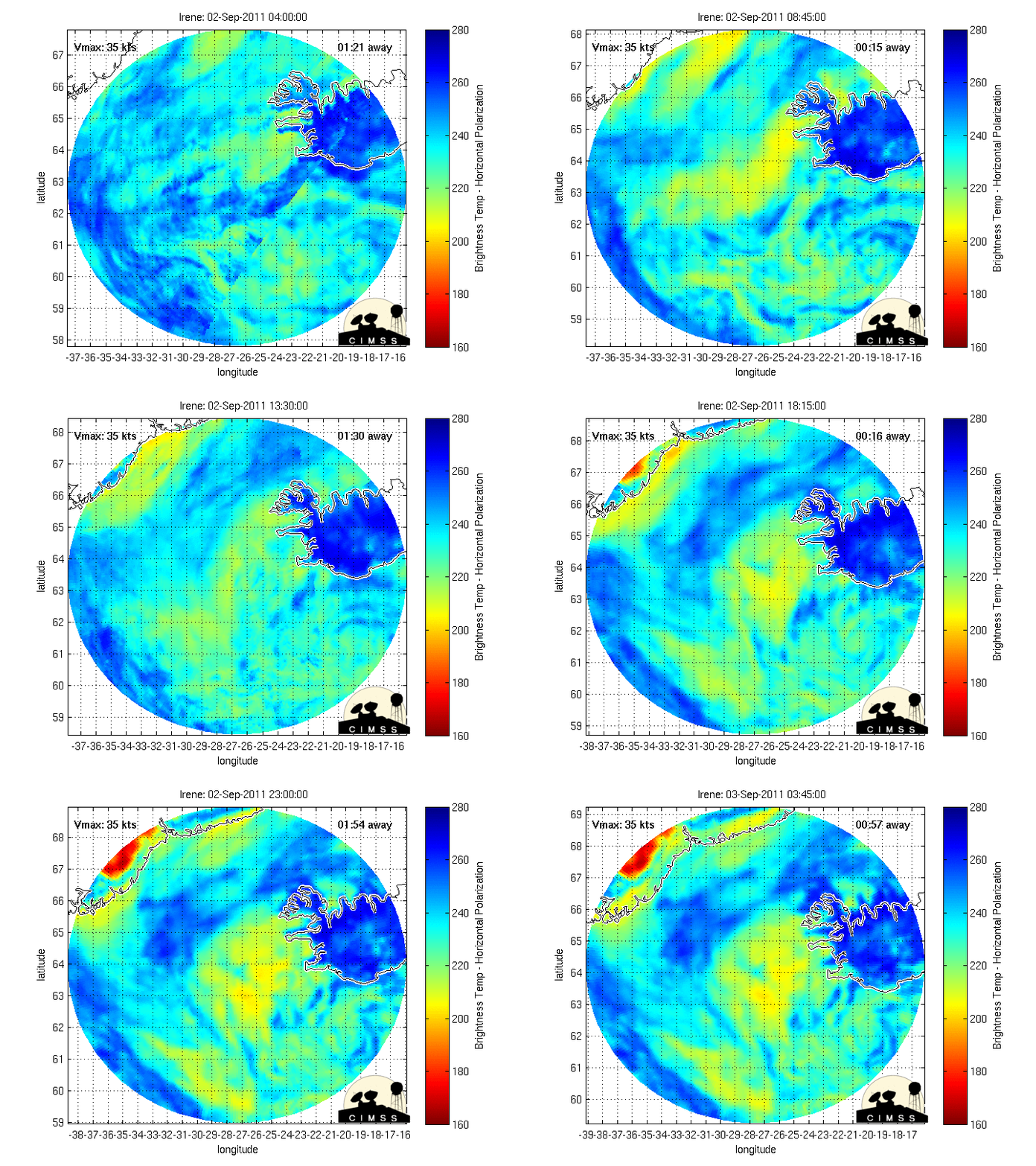
Look at this microwave image of her as of late, she's basically been on a drunken stumble.  :P

3178
Local Forecast / Re: General LF Discussion
« on: August 25, 2011, 09:43:14 PM »
Chasing in The Wind at :18 :blink:

What was the song at :08 and :28? I know it's from the morning list.

Wild shot in the dark, but I'm gonna assume it was "Horizon" by Paul Taylor.

3179
Local Forecast / Re: General LF Discussion
« on: August 25, 2011, 08:59:02 PM »
Your new SA = Random Playlist Music  :P

Either that or Paul Taylor is the new Trammell Starks tonight. :blink:

3180
Local Forecast / Re: General LF Discussion
« on: August 25, 2011, 07:58:30 PM »
Windchimes by 7and5 at :48 :huh:

Horizon by Paul Taylor right now.

Pages: 1 ... 210 211 [212] 213 214 ... 470